
The Human Impact
Education, Amenities and Recreation
Education
Originally there was just one school in the village, an all-age school called Barton Free School, founded by Thomas Russell in his will of 1593, but not named after him until 1957. Russell’s school was supervised by the Drapers’ Company of London, in accordance with the wishes of his will, until the late 1800’s. Various small private schools were set up in the eighteenth and nineteenth centuries. The County Council, predicting a large increase in the population of the district from the mid-1950’s, had decided to build a rural secondary modern school in Barton under Needwood, and this opened in 1957, taking all senior pupils from Russell’s school, as well as catering for a wider catchment area. This school became a comprehensive in the early 1970’s. A separate junior school was opened in 1968, leaving Russell’s school catering for infants only. The secondary school was named after John Taylor, ( Henry VIII’s Master of the Rolls ), whilst the other two schools were named after Thomas Russell. So, with three schools, the village is well catered for.
Amenities
Barton under Needwood has a large number of amenities for its size. It has been argued that it might have had more, were it not for its close proximity to Burton upon Trent and Lichfield. The amenities include a health centre, a police station, a fire station, a telephone exchange, a library, a very attractive fishpond, two childrens’ play areas, a youth centre, a large village hall and a valuable cottage hospital. Two further halls are attached to churches. There are four churches, i.e. the Church of England Parish Church of St.James, the Roman Catholic Church of Our Lady, a Methodist Church and a Christadelphian Church.
Recreation
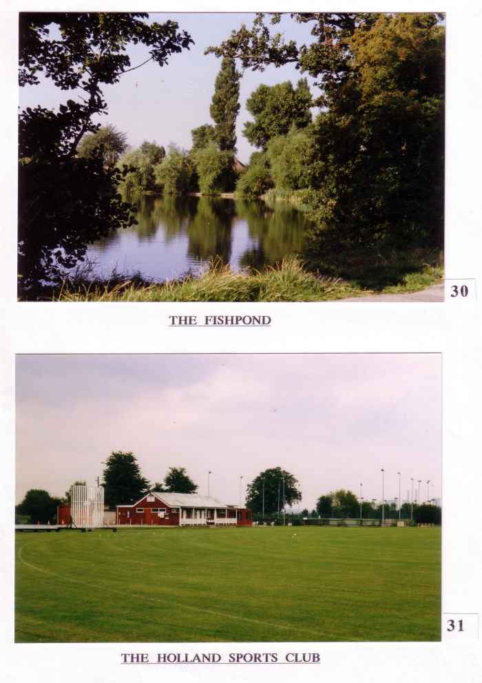
The recreational opportunities are many and varied, catering for wide interests. The following lists some of them :- the Holland Sports Club, ( see above), the Barton Bowls Club, the Red Cross, the British Legion, the Womens’ Institute, the Civic Society, the Barton Players, the Gardening Guild, the Scouts and Guides, the Bell-ringers, the Footpath Group, the Badminton Club, the line-dancing group and the Mayflower Club. The possibility of making maximum use of our own stretch of the Trent and Mersey Canal by constructing a marina was first suggested in the Report of the Parish Council Environmental Development Committee of 1976. It was hoped that the Parish Council would build it and run it in the interests of local people. The idea was revived again recently, this time by a private developer. The project has come to fruition and seems to be flourishing. The marina, combined with the areas newly planted with trees, and the lakes devoted to wildfowl, south of Station Road, are making a valuable contribution to Parish recreational opportunities.
Rights Of Way
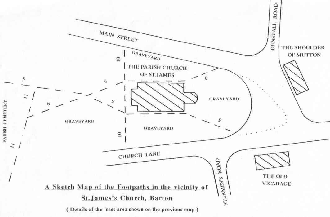
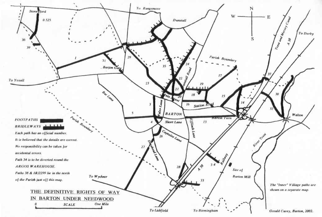 The Parish also possesses a large network of rights of way which it has inherited from the time when agricultural workers had to walk to work in the fields, and when most people had to walk to the middle of the village. In 1968 each parish was required to designate which paths it considered to be rights of way. Each path was numbered and the resulting Definitive Footpath Maps were incorporated into the 1968 Countryside Act. The three accompanying maps show the rights of way in Barton. Whilst most are footpaths, some are bridleways. As a member of Barton under Needwood Parish Council in the 1970’s, I was fortunate to have been instrumental in installing road-side signposts for the majority of these paths and bridleways. I also carried out a complete survey of all rights of way in the Parish for the County Council at about the same time, because it was clear that they would be needed as a means of recreation as the village grew bigger. Many paths had obstructions like barbed wire, broken bridges and overgrown hedges, and it was important to get these things put right.

Footpaths and bridleways are amenities which form part of our heritage. Some have been lost altogether, whilst others have been diverted in zig-zag fashion through housing estates, running between high fences.
In recent years a village footpath group has been formed and some members of this group have assumed the task of keeping the paths in good order. They have already repaired, or renewed, several stiles and gates, and they have way-marked the routes of many paths.
” Jog on, jog on the footpath way,
And merrily hent the stile-A ;
A merry heart goes all the day,
Your sad tires in a mile-A. “
( Shakespeare, ” A Winter’s Tale “.)
( hent = reach or grasp )
NB. The accompanying maps of the Definitive Rights of Way are for guidance only. I would recommend the reader to consult the Ordnance Survey maps listed earlier.